When starting any land development or civil construction project, the surveyors first job on site is to establish accurate primary survey control that can be used throughout the project.
It is important that the primary control is accurate as all secondary survey control stations will be established from it, and if GNSS receivers are being used by the surveyor or the civil contractors machinery on site, it is likely that their base will be setup on one of these primary surveying control marks.
What Is a Surveying Control Point?
A surveying control point is a mark or monument that has an established horizontal and vertical position by way of being surveyed and is identifiable on the ground.
Control points are established, managed, maintained and replaced by surveyors and are created at the start of any land development or civil construction project.
Surveying control points are very important and once established, need to be protected from being damaged or disturbed. If they do get disturbed and moved from their original surveyed position, a new survey will need to be completed to re-coordinate its new position.

How Do You Measure the Location of New Survey Control Points?
To measure the horizontal and vertical position of a new survey control point, you need to start your survey on at least 2 known points (3 preferred for checks).
The different types of equipment that you would use to establish new survey control and the methods used are as follows.
Total Station
The conventional way to extend and establish survey control on a project would be to use a total station.
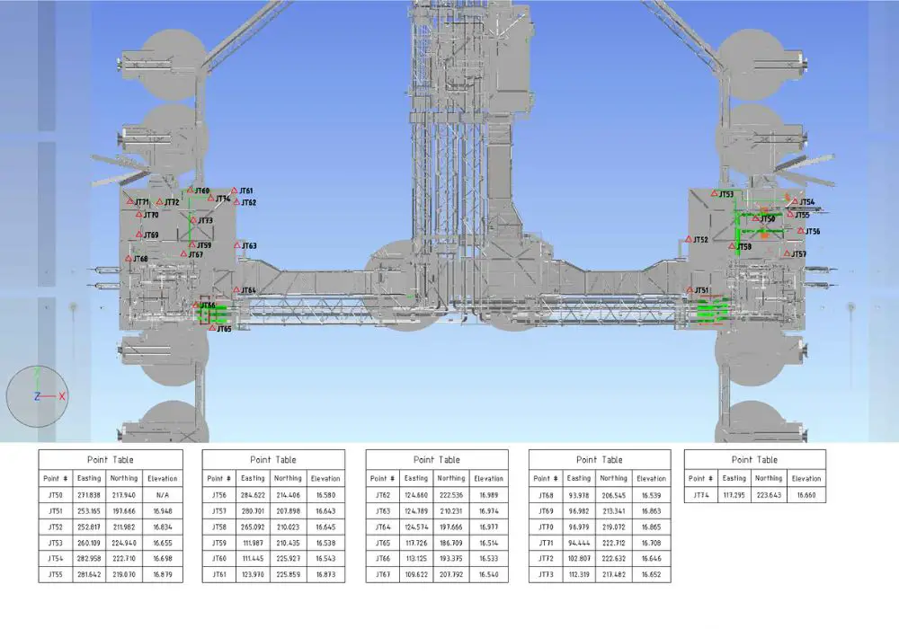
The methodology for establishing new survey control from the below example would be:
- Setup your total station on existing survey control point Pt 101, setup targets on existing point Pt 100, and new control point Pt 200. From Pt 101, set your backsight (BS) to Pt 100, and then turn to and measure Pt 200.
- Move total station to newly surveyed point Pt 200. Setup targets on the existing control station Pt 101, and new control point Pt 201. From Pt 200, set your BS to Pt 101 and then turn to and measure Pt 201.
- Move total station to newly surveyed point Pt 201. Setup targets on the new control station Pt 200, and existing control point Pt 102. From Pt 010, set your BS to Pt 200 and then turn to and do a check measure to Pt 102.
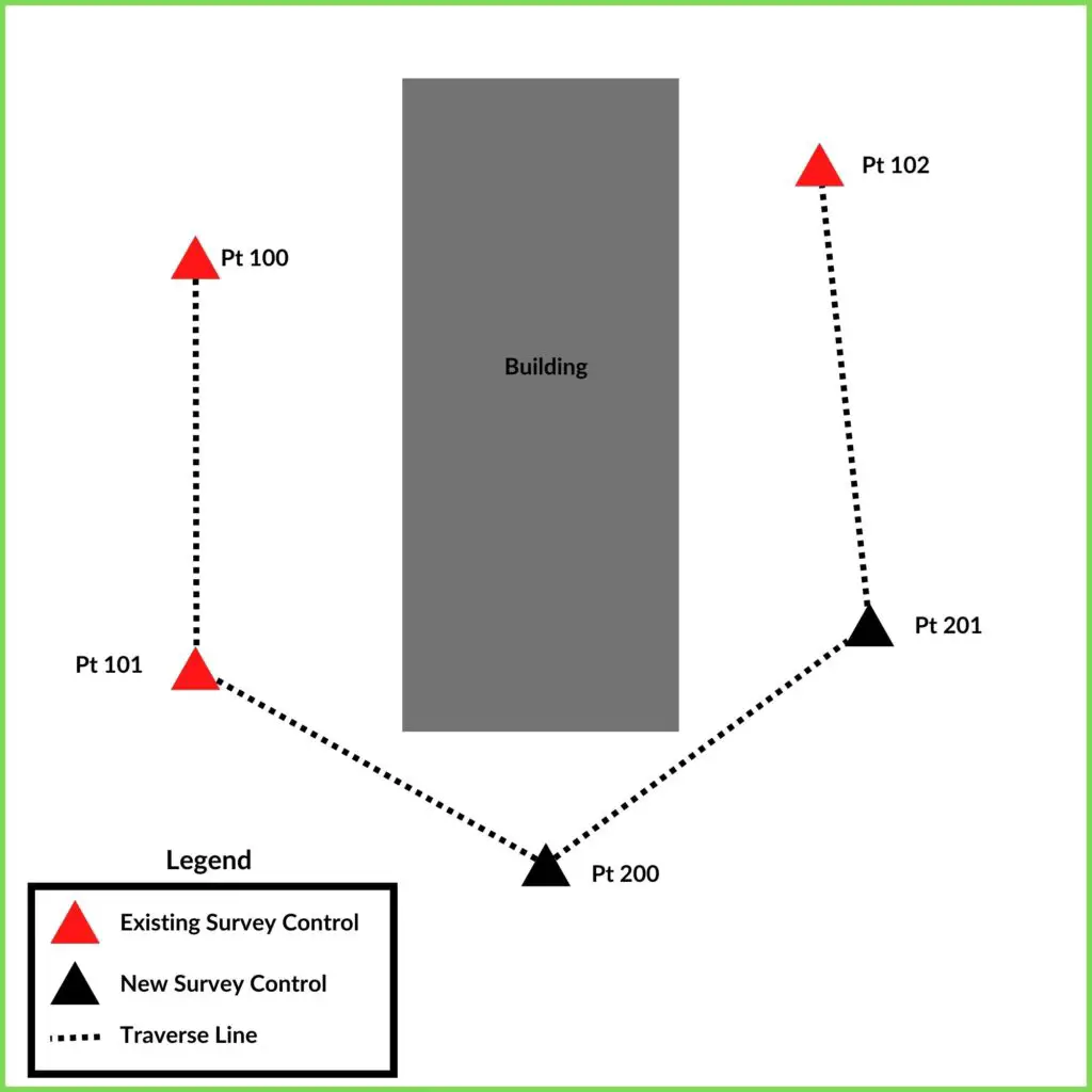
This is a very basic example but it highlights the steps needed to establish new survey control from an existing network of control stations.
When Would You Use a Total Station to Establish New Survey Control?
You would use a total station to establish new survey control if the project you are working on requires a high level of accuracy. Projects such as the following require accurate and traceable measurements.
- Boundary surveys,
- Civil and construction surveys,
- Steel, Mechanical and Piping (SMP) surveys, and
- Feature and contour surveys.
Accuracy
Common survey grade total stations have a horizontal distance measurement accuracy of 1mm to 3mm, and angular accuracy of 1″ to 3″. If your survey equipment is in good measuring condition and the project needs an accurate layout of points to meet the accuracy requirements of the project, then the total station is the best option to use.
Efficency
If your site is small enough that you have a line of sight between control stations, or it is only a couple of change points between control stations, it is definitely the fastest method to establish new control.
GNSS Receivers
Survey control can be established using GNSS receivers. There are two common types of survey methodologies to do this; (1) Static Surveys and (2) RTK Surveys.
GNSS Classic Static Survey
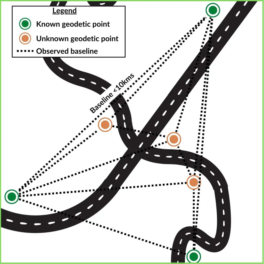
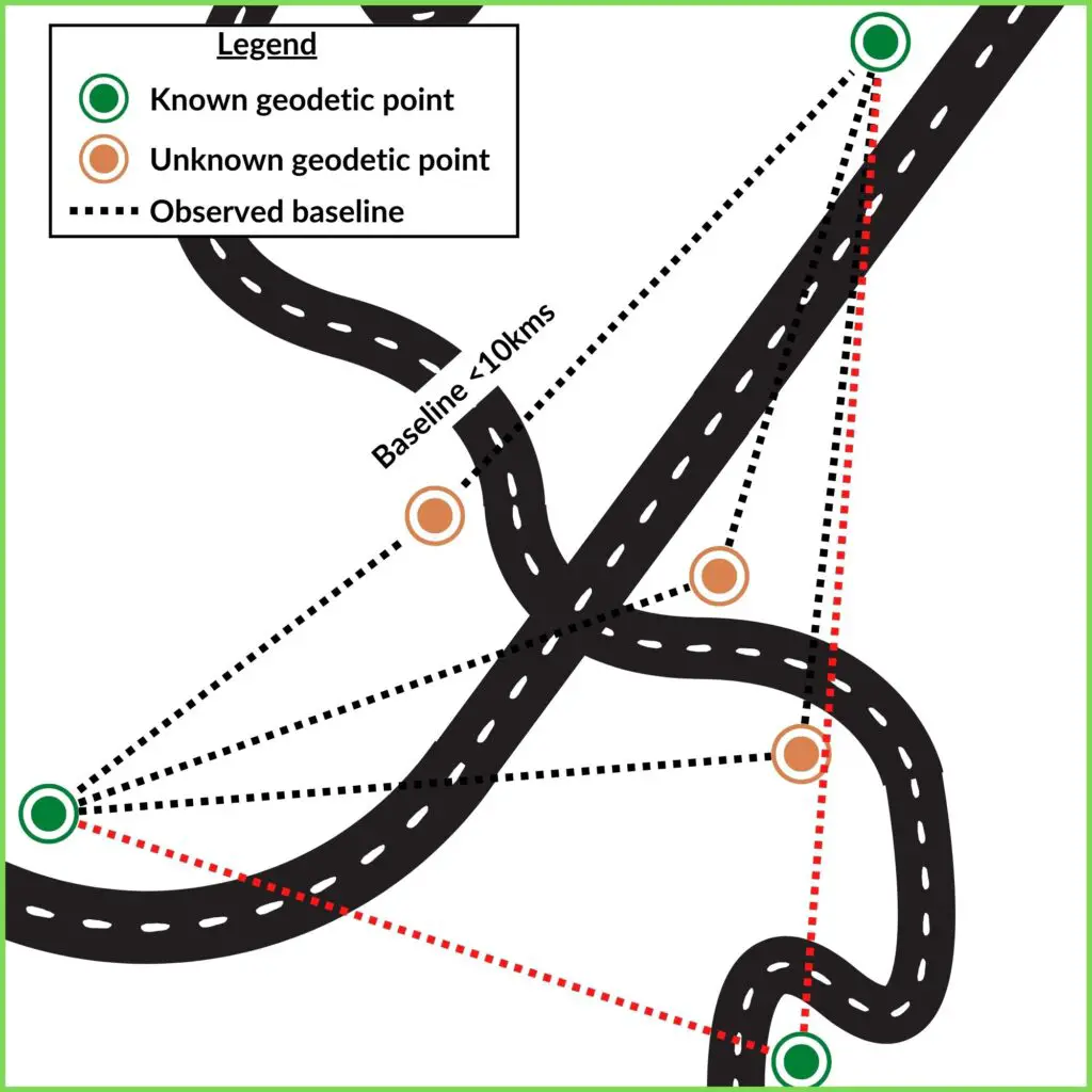
If you are establishing new survey control for a remote project and there isn’t any existing control on or near site, then a GNSS Classic Static Survey may be the preferred method.
GNSS classic static surveys involve setting up GNSS receivers on known and unknown geodetic survey marks and simultaneously observing the baseline between the points.
This method is ideal when transferring control over long distances to remote projects where there isn’t any existing, or sufficient control. Classic static surveys are acceptable for baselines less than 10kms [Source: SP1] and if done properly can achieve horizontal accuracies of +/-15mm survey uncertainty (SU) and vertical accuracy of +/-20mm SU [SP1].
GNSS RTK Survey
If the project you are working on doesn’t require a high level of accuracy, then you could be justified in using GNSS RTK survey method.
This method is when you have your GNSS base station set upa over a single known point, and it sends out corrections in real-time to the rover GNSS receiver when surveying new points.
To make these types of surveys more accurate when surveying in new survey control, you can survey the new control points from two known points and average the difference.
Projects, where this type of survey methodology would be suitable, are bulk earthworks projects.
Dumpy/Digital Level
If you need to transfer an accurate level around existing and new control on a site, then doing a level run with either a dumpy or digital level is the best way to do that.
Why Are Control Points Important?
Survey control points are important to land and civil projects because they are necessary for the surveyor to be able to accurately setout; (1) design points or gridlines, (2) sensitive or property boundaries, or (3) locate existing services on-site to prevent a service strike.
The surveying control is also important because it links all stages of a project together:
- The initial site control and detail survey is completed and sent to relevant designers (engineers, architects, surveyors, etc) to draft and prepare a design.
- The design from the engineers is then setout on site using the same control points/site datum that was initial established during the site survey.
- An as-built survey is completed of features and services that were built during the project.
All three phases in a project listed above are spatially related to each other because the same survey control (or same site datum) was used throughout the project.
When Does Survey Control Need to Be Established?
Establishing survey control is one of the first things a surveyor would do on a new site. Without any survey control, a surveyor would not be able to complete their tasks.
Survey control marks will need to be maintained and replaced as they may get disturbed or destroyed during the construction phases of a project.
How to Decide Where to Place Survey Control Stations?
When surveying new control on a site the following should be considered before deciding where to place them:
- Will it be clear of future works?
- It is accessible?
- Are there going to be any obstructions placed around the control mark (like fencing)?
- If you are going to place a GPS/GNSS base station on the control mark, are there any GPS window obstructions?
You won’t always be able to put in the perfect marks when installing new survey control, sometimes you will place survey control knowing that it will eventually get destroyed. But if you consider the above list then that should assist you in deciding where to place your survey control.
How Many Survey Control Points Need to Be Established on A Project?
There is no rule for how many primary or secondary control points you need to have on a project. You only need as many survey control points as you need to be able to complete your job.
It is best practice to have more control points than you need in case any marks get destroyed. If you only have the minimum number of control points and one gets destroyed, then you are not able to complete your work.
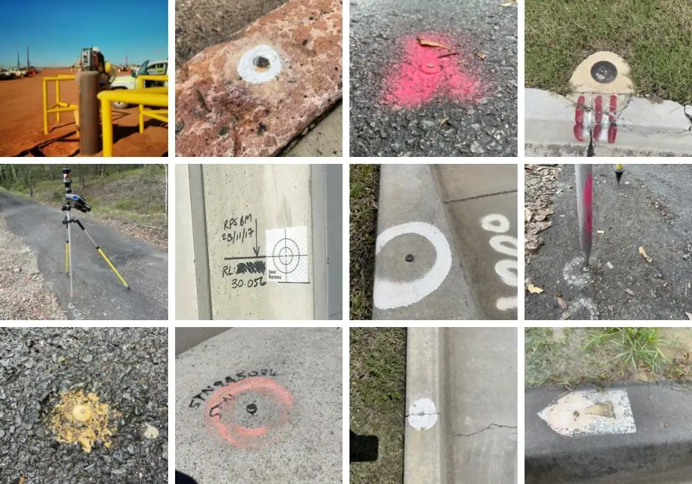
Types of Control Points in Surveying
Surveyors use many different types of ground control points depending on the circumstances of each job.
Not all control points are as stable and long lasting as others. Below I list out what I consider to be primary and secondary control points.
- Primary control points (first order) are what I would consider to be long last points, and to be used when establishing secondary control points (second and third order points).
- Secondary control points aren’t as long lasting and stable as primary control points, but they are important to protect and if positioned correctly can last a long time on a project.
A good ground control point is one that is visible and usable for surveying and setout on a site, and is stable and reliable to use.
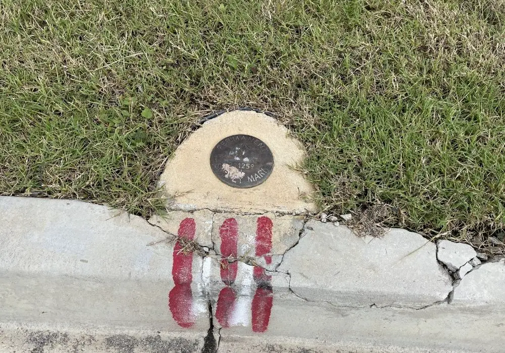
Primary Survey Control Marks (First Order)
What are primary controls in surveying?
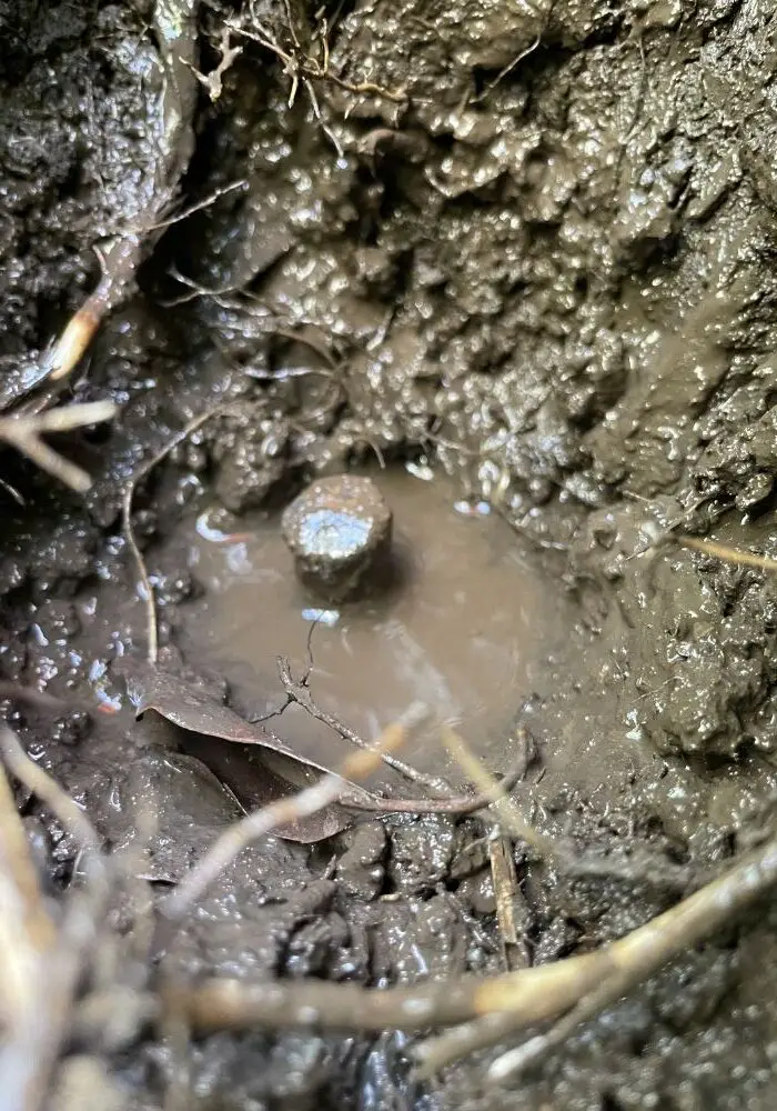
Primary control marks are usually a more stable type of mark, and involves more labour to build and measure. Primary control marks that I have used on projects include:
- A brass plaque set in concrete,
- Mini mark set in the concrete footpath,
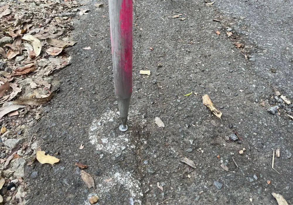
- Deep-driven steel rod, and
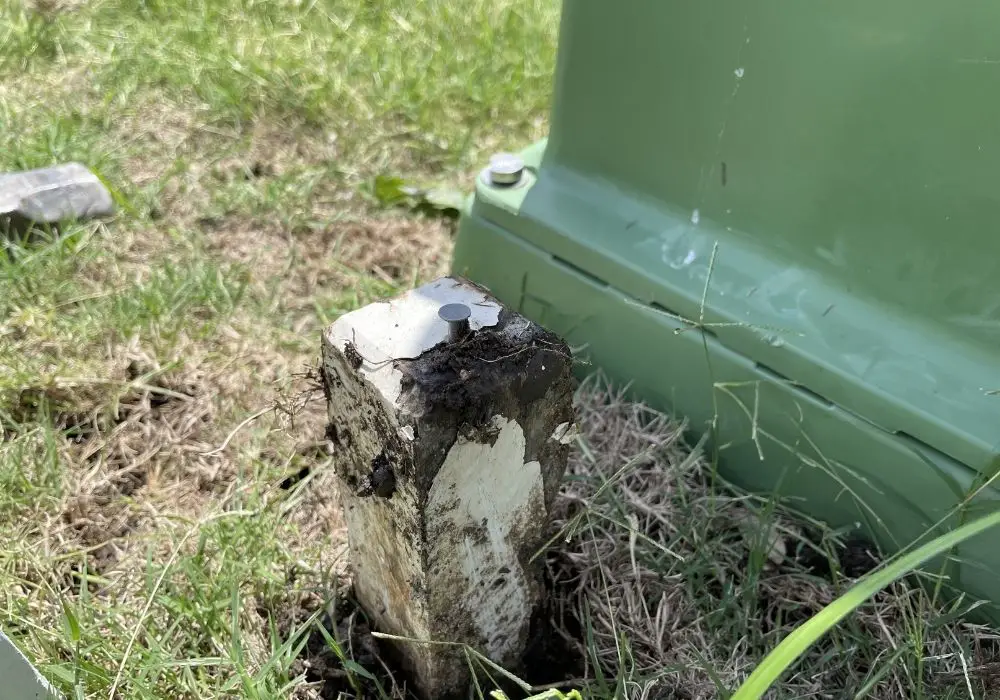
- A concrete pillar either set in a steel pillar driven into the ground or a concrete pillar cast in place.
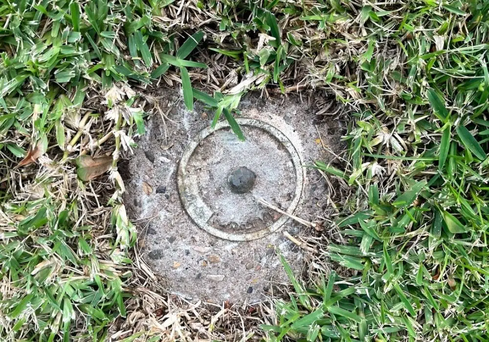

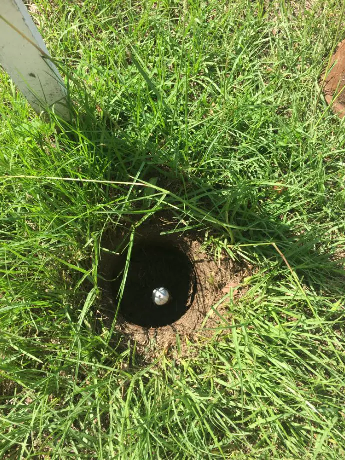

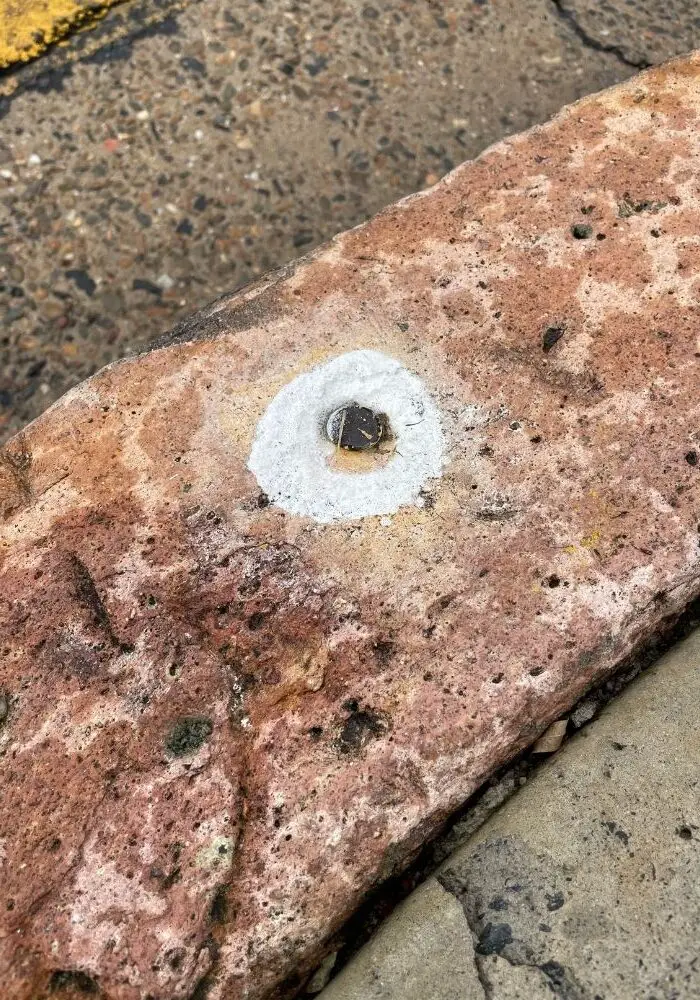
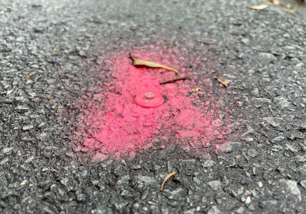
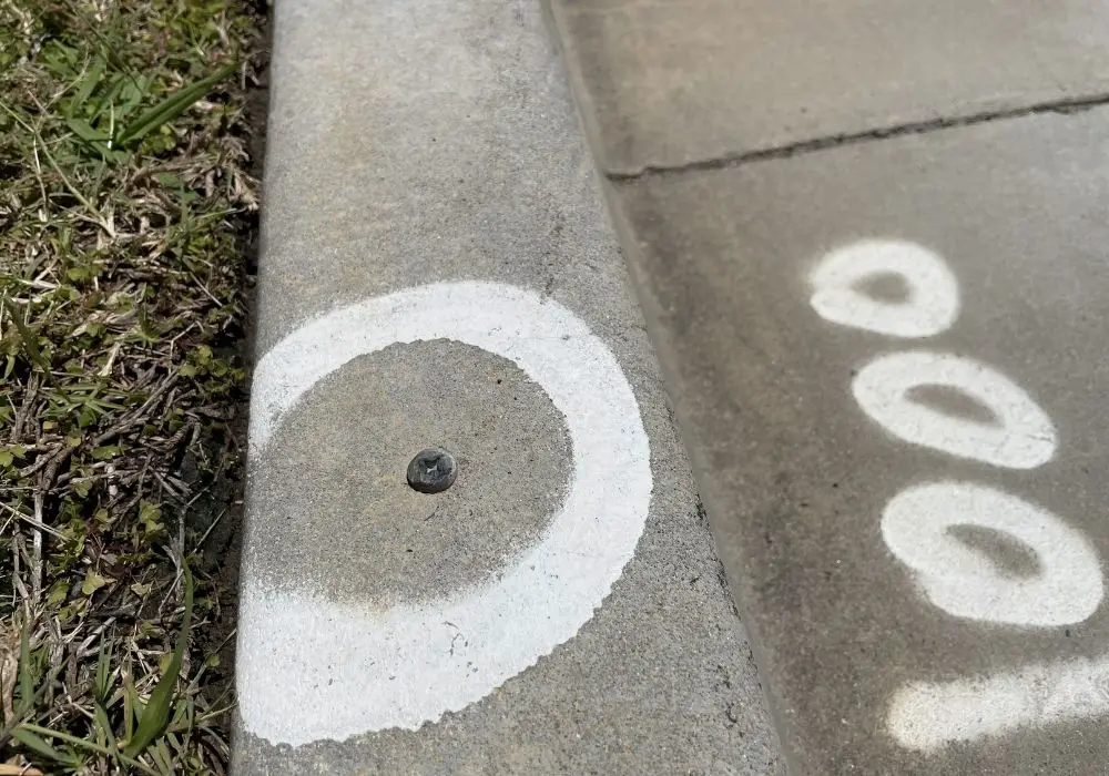
Secondary Survey Control Marks (Second & Third Order)
Secondary control marks are more temporary in nature and can be more easily disturbed. Types of secondary control include:
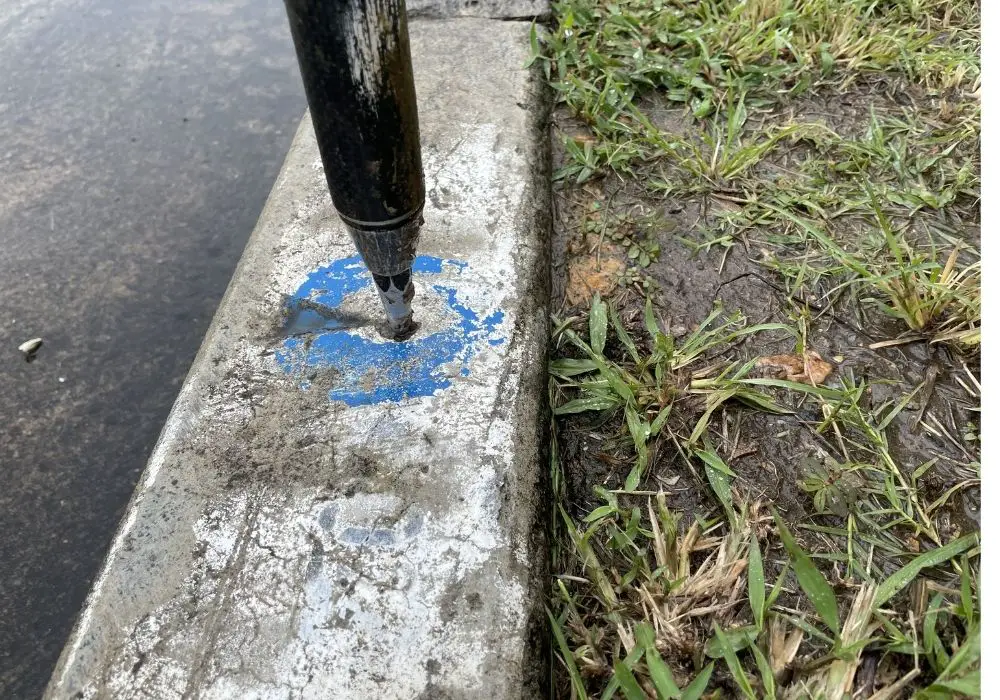
- Screws, nails or bolts in concrete kerb or footpath,
- Reflective stickers placed on fixed structures, and
- Nail in bitumen road.

Cadastral Survey Control Marks
The types of surveying marks used in cadastral surveys are:
- Wooden pegs to mark the boundary,
- Nails, screws or drill holes in concrete kerb or footpath, or
- Buried iron pins.
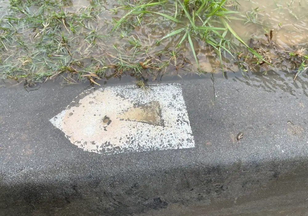
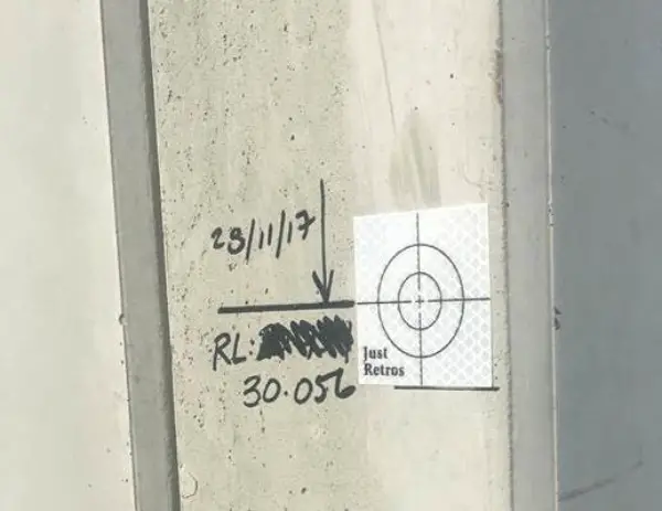
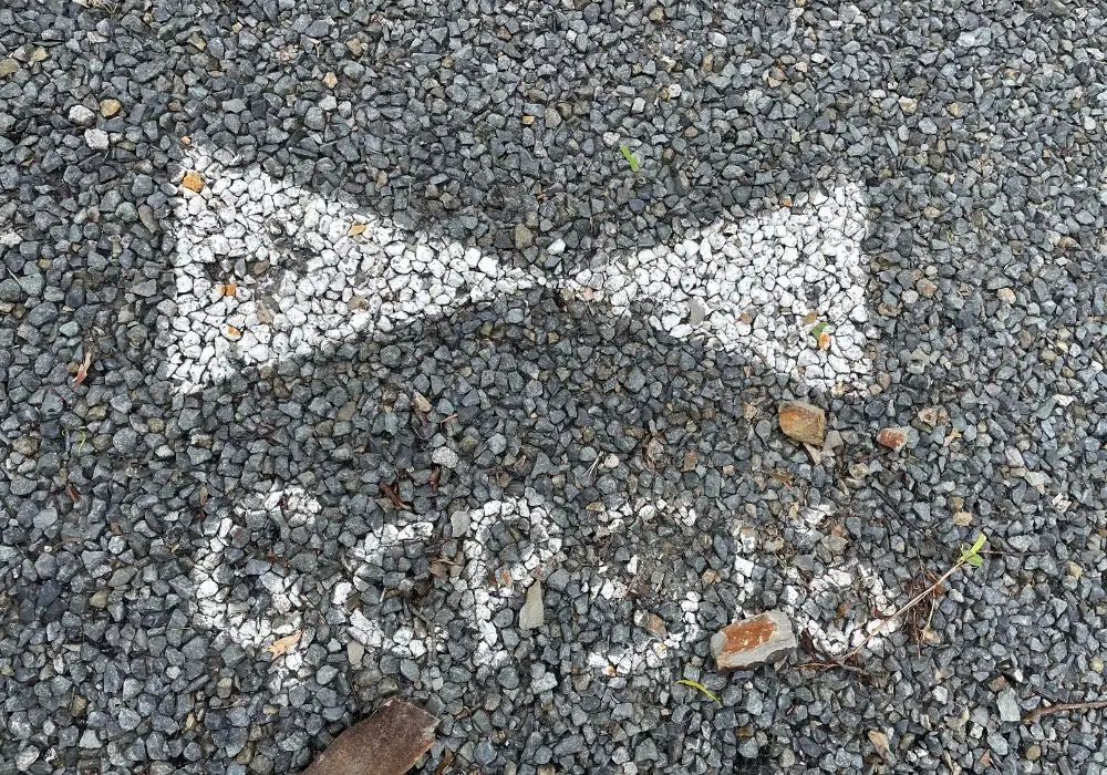
Aerial Survey Control Marks
Aerial control marks are usually a checkerboard style. The intersection of the checkerboard (or triangles as below) is what the surveyed point will be, and when the aerial surveyor is identifying the marks to register from their photos, they will be able to easily click the pixels that match up with the middle of the checkerboard.
FAQs
What Is the Difference Between a Control Point and A Benchmark?
A control point is a mark or monument that has a known horizontal and vertical position. A benchmark is a mark or monument that has a known vertical position only.
Control points that have a suitably accurate vertical position can be used as benchmarks as well.
What Is a Control Survey?
A control survey is the process of establishing survey control points that can be used to provide surveying services on a land development or civil construction project.
What Are the Types of Control Networks in Surveying?
There are two primary types of control networks in surveying, (1) site control networks and (2) geodetic control networks.
