Surveyors and the spatial data that they collect, and present are critical to the successful planning and completion of civil engineering projects. Surveying and its importance to civil engineering cannot be overstated and plays a vital role in areas such as:
- Identifying and establishing property boundaries.
- Collecting spatial information about a site.
- Producing paper and digital plans of their spatial data.
- Ensuring sites are built to design and within construction tolerances.
- Completing as-constructed surveys of the completed project.
Accurate and reliable surveys are essential to prevent costly errors in a project and are crucial for a smooth project.
Surveying in Civil Engineering Projects
Surveyors are critical to a variety of civil engineering projects. The types of projects that would require a surveyor throughout the duration of the project include:
- Roads
- Bridges
- Railways
- Tunnels
- Pipelines
- Dams
- Ports
- Utilities
- Building foundations
Some of the key benefits of having accurate surveys done on the above projects include:
- Spatial data. Accurate spatial information is critical throughout the lifespan of civil engineering projects.
- Cost savings. By providing accurate spatial information or by setting out features correctly to design, surveying can help projects avoid costly mistakes and any reworks.
- Increased safety. Surveyors can help identify high-risk areas such as live underground services. Having accurate surveys of what is buried beneath the ground is vital to the safety of site workers.
- Compliance. Accurate surveys are the best way to ensure that the project is built as per its design and engineering specifications.
Role and Responsibility of Surveyors in Civil Engineering
Surveyors play a crucial role in civil engineering projects.
At the start of a civil engineering project, a surveyor will do an initial site contour and detail survey, which will be used by engineers to design the project, which will capture features such as:
- The existing natural features of the site.
- The existing constructed features of a site such as roads, communication, and electrical utilities.
- Surveyed property boundaries.
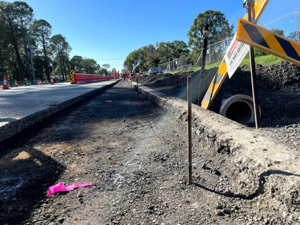
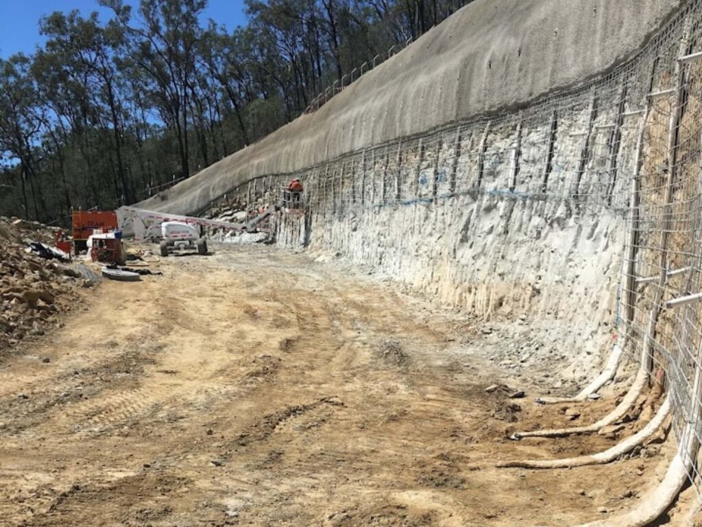
After the initial site design and planning phase, the surveyors’ involvement in a civil engineering project will be setting out the design of the project to assist machine operators, trades, and other professionals to do their work as per design.
Both during the project and once the construction works are done, a surveyor will then survey all the above-ground and underground features as a record of what has been built on site.
Surveying Instruments Used In Civil Engineering
There are a range of instruments that are used in civil engineering projects depending on the task being done, and the accuracy requirements of the task.
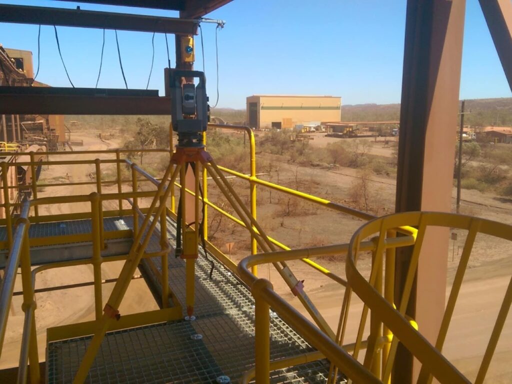
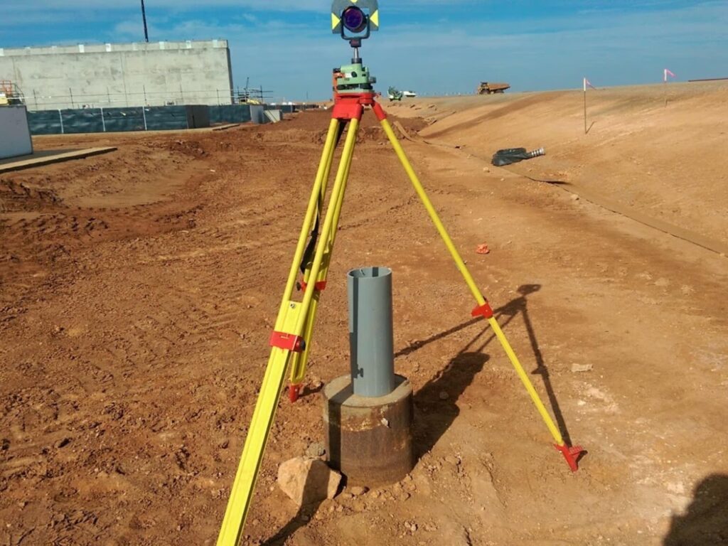
Total Stations. The most common surveying instrument that is used in civil engineering projects is the total station. Total stations combine the functionality of a theodolite and an electronic distance measurer (EDM). They are able to precisely observe and measure horizontal and vertical angles, and slope distances.
The useability of total stations increases when used with a survey controller. Survey controllers have applications that can set out points and lines and surfaces on the fly in the field. They can also measure and store points which can then be shared with other professionals who would use that data.
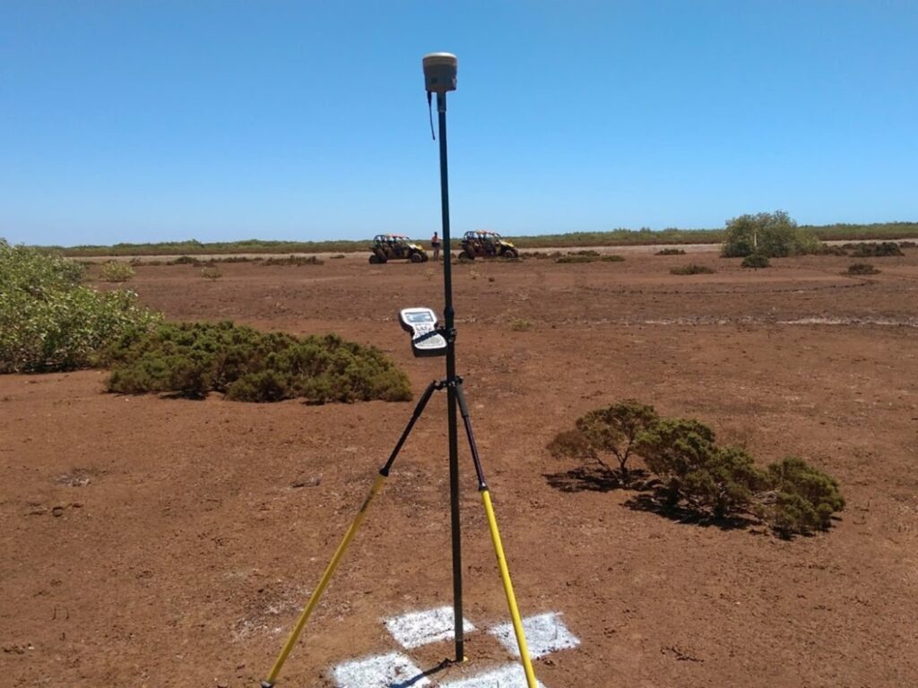
Real-Time Kinematic Global Position Systems (RTK GPS) Receivers. RTK GPS is a fast and convenient surveying instrument that can set out and record points in the field but is not as accurate as a total station.
RTK GPS receivers are suitable to use for bulk earthworks or for tasks where there isn’t a need for points to be stored or set out with an accuracy of less than 20 to 30 millimeters accuracy.
The benefit of using RTK GPS over a total station is that you don’t need line of sight to an instrument to measure and store points. As long as it is able to see a sufficient number of satellites in the sky, then it is able to work.
3D Laser Scanners can collect large amounts of data very quickly with high precision. They are used in civil engineering projects either at the initial stages of the project, to survey the existing natural and built environment, or to survey the newly constructed structures as evidence of what was built.
The benefits of laser scanners include being able to survey objects without needing access to them, like a busy road or a high building. 3D laser scanners are not able to be used like total station though and can’t set out points in the field.
Drones have increased the speed and efficiency of surveyors working on large civil engineering projects like roading jobs. They can survey large areas by having an onboard camera or LiDAR scanner.
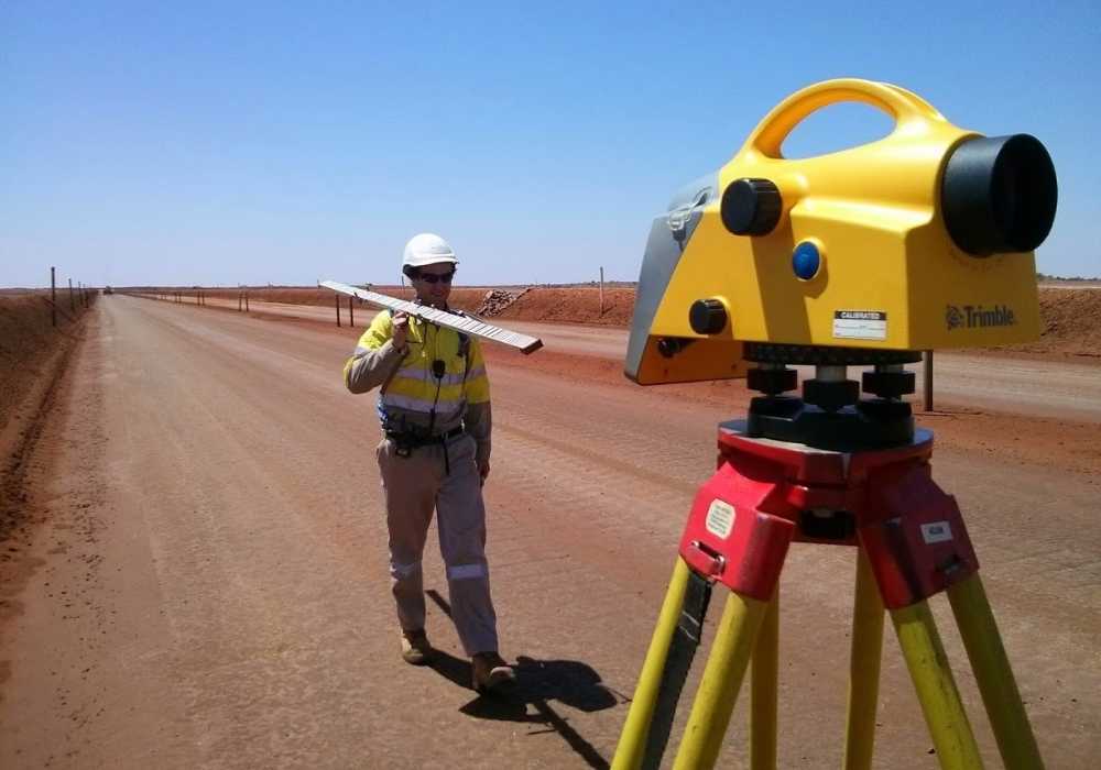
Levels. For almost every project, having a well-kept network of survey control points is very important. To accurately transfer levels between benchmarks and survey control stations on a site, a digital or dumpy level is the only tool able to do that accurately.
Surveying Techniques Used in Civil Engineering
The different types of surveys and survey techniques that can be utilized on a civil engineering site include the below:
Boundary Surveys. One of the first and most important surveys on a civil engineering project is the location and identification of the property boundaries of the project. If the construction of a project goes outside of the property boundary, unless agreed upon in advance, it will likely result in expensive reworks to correct the error.
Control Surveys. To be able to complete work accurately and quickly, surveyors need to have multiple control points located around their work area or site. Control surveys establish the control of a project.
Set Out Surveys. So that the project is built as per the design, a surveyor will calculate and set out the design points needed on a civil engineering project.
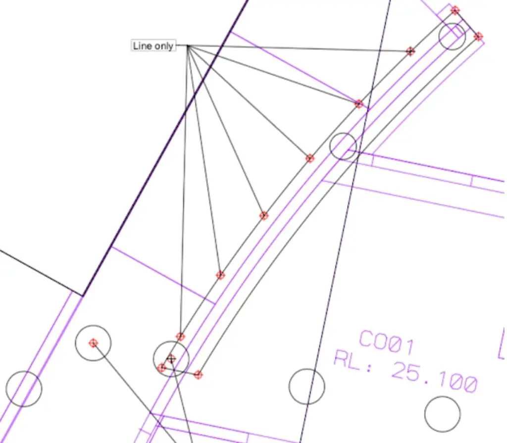
Topographic Surveys. Surveys capturing existing and new features will be done throughout the life of a project. A topographic survey is the process of measuring and storing points, to be plotted on a plan for use by other professionals.
Levelling Surveys. Leveling surveys are used to set benchmarks on-site or to level survey control stations.
Aerial Surveys are the process of flying aircraft over a site and capturing data using either photogrammetry or other sensors like LiDAR.
Hydrographic Surveys are done in bodies of water and are needed in projects where there is any dredging of sand or marine piling works or planning work that involves large bodies of water.
Applications and Users of Surveying in Civil Engineering
Surveying is an essential field in the civil engineering world and plays a crucial role in all phases of a project from planning, design, construction, and maintenance of infrastructure and construction projects.
